| Above: Fishing boats are seen moored as a part of precautionary measures as Cyclone Vayu nears the Gujarat coastline at Veraval Port on June 13, 2019. Image credit: SAM PANTHAKY/AFP/Getty Images. |
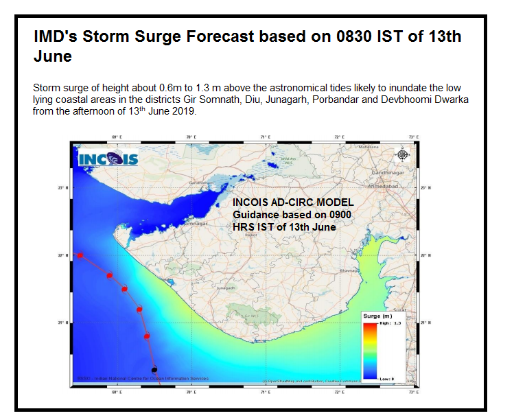
Category 2 Tropical Cyclone Vayu put on the brakes Wednesday night as it lumbered towards western India and is now expected to skirt the coast without making landfall. Nevertheless, Vayu has brought damaging wind, waves and heavy rain to the coast. According to AP, power was knocked out to 560 villages in India’s Gujarat state, where 62 million people live. About 300,000 people were evacuated from low-lying areas of Gujarat, where a storm surge of up to 2 meters (6.5 feet) was initially feared. This forecast has been reduced to 1.3 meters (4.3 feet) for Thursday afternoon and evening.
 |
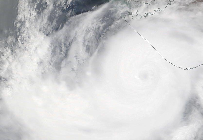
Figure 1. MODIS image of Tropical Cyclone Vayu skirting the coast of western India on Thursday morning, June 13, 2019. Image credit: NASA. |
As of 12Z (8 am EDT) Thursday, the Joint Typhoon Warning Center placed the center of Vayu about 90 miles west of the coast of India. The storm had top winds of 110 mph and was headed north-northwest at 4 mph, parallel to the coast. The cyclone had a sprawling circulation, with tropical-storm-force winds extending out 145 – 170 miles on the east side of the storm.
 |
| Figure 2. Predicted storm surge for Vayu from IMD. |
Forecast for Vayu
Vayu is likely to bring additional rains of up to 3 inches along the western coast of India's Gujarat state, with tropical-storm-force winds of 39 mph or greater possible through late Thursday. A storm surge of up to 1.3 meters (4.3 feet) is also possible, according to the India Meteorological Department.
Vayu is likely to be the final hurricane-strength tropical cyclone to trouble India this summer, since the advancing monsoon is beginning to dominate the circulation over the Arabian Sea and Bay of Bengal, making it difficult for strong tropical cyclones to form. India typically has another cyclone season in late October and November, after the monsoon wanes.


