| Above: Super Typhoon Lan as seen by the VIIRS instrument on NOAA’s Suomi satellite on Saturday afternoon, October 21, 2017. At the time, Lan was a high-end Category 4 storm with 155 mph winds. See also this impressive visible zoomed-in loop of Lan’s eye on Saturday, courtesy of Dan Lindsey of NOAA. |
Update: Typhoon Lan made landfall near Omaezaki City, Japan, about 120 miles southwest of Tokyo, near 3 am JST Monday. At landfall, Lan was a Category 2 storm with sustained 1-minute winds of 105 mph. Lan drenched Japan’s main island of Honshu with dangerous torrential rains on Sunday as the Category 3 typhoon, with sustained winds of 120 mph at 8 am EDT Sunday, sped northeast at 29 mph towards Tokyo. Lan was interacting with a frontal system that has brought high wind shear and dry air into the typhoon, resulting in the collapse of its inner core. Passage over cool waters of 25°C (77°F) as Lan approached the coast caused further weakening to a Category 2 typhoon at landfall.
 |
| Figure 1. Landslide risk from Lan as determined by the Japan Meteorological Agency at 2030 JST Sunday, October 22, 2017. |
Torrential rains and high landslide risk
While high winds will cause considerable damage and loss of power across much of Honshu, Lan’s primary threat is heavy rain. A moist flow of tropical air interacting with a stalled front had already begun to trigger heavy rains over Japan on Friday, and now that Lan’s rains have reached the nation (see latest Japanese radar images), record 48-hour rainfall amounts have been observed in some locations. As of 2120 JST Sunday, Lan brought a record 48-hour rainfall amount for October of 700 mm (27.56”) to Shingu, located about 300 miles southwest of Tokyo. In records going back to 1976, the highest 48-hour rainfall there for any month was 782 mm (30.79”). Kamoda, in the Shikoku region, also set an October 48-hour rainfall record today, with 299.5 mm (11.79”). Additional heavy rains of over 10” are expected over some areas of Japan.
 |
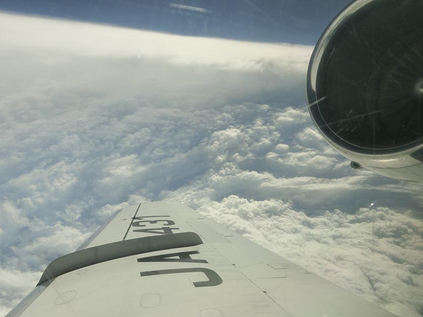
| Figure 2. Super Typhoon Lan as seen by the T-PARCII G-II research aircraft on Saturday afternoon, October 21, 2017. Image credit: Kosuke Ito and the Tropical cyclones-Pacific Asian Research Campaign for Improvement of Intensity estimations/forecasts (T-PARCII) program. |
Research flight into Lan
The first aircraft mission of a typhoon research project called the Tropical cyclones-Pacific Asian Research Campaign for Improvement of Intensity estimations/forecasts (T-PARCII) saw a G-II aircraft fly into Lan on Saturday, dropping 21 dropsonde probes around the storm from 43,000 feet. The west side of the eyewall was weak during the flight, which allowed the aircraft to penetrate into the eye and capture this remarkable video of the center. The aircraft measured a central pressure of 925 mb in Lan during their eye penetration. Thanks go to Kosuke Ito, Assistant Professor of the Department of Physics and Earth Sciences at the University of the Ryukyus, Japan for this photo and info.


